You can choose the symbols, colors, line thickness and so on used for your waypoints,
tracks and routes.
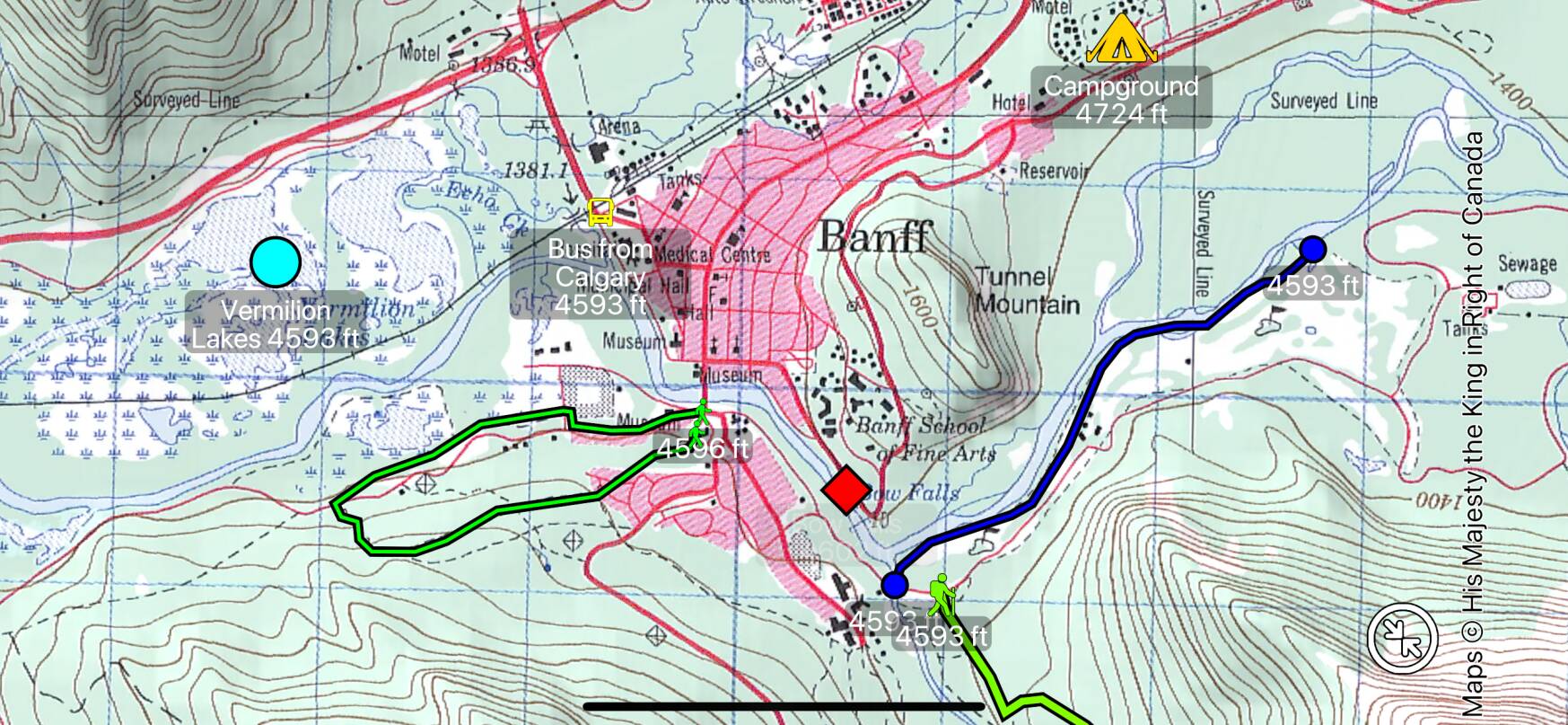
How to Set and Change Styles
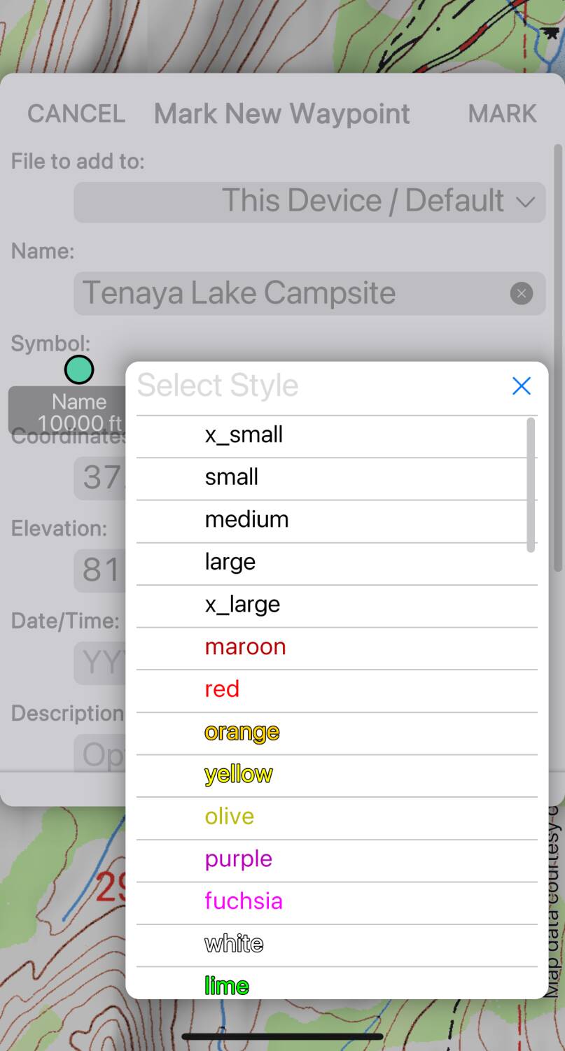
You can set styles for individual waypoints, tracks and routes when you create them.
The style selector presents a list of individual styles from which you can select a
combination. The styles include:
- Sizes:
- Extra small to extra large, which determine the sizes of the symbols and the thickness of the lines.
- Colors.
- Symbols:
- Including geometric shapes and activity or feature-related icons. For tracks and routes, these symbols are used at the start and end of the line.
- Additional styles as described below.
Typically you might choose one each of size, color and symbol.
Later, you can change the style by selecting the item on the map and tapping
, or by locating it in the Files screen and
tapping .
Default Styles
It is also possible to set a default style for a file. Do this when creating
the file, or later using the file’s button in the
Files screen. File default styles are over-ridden by styles applied to individual
items.
Variable Color Styles
The app supports a number of special styles that cause the color to change in some way:
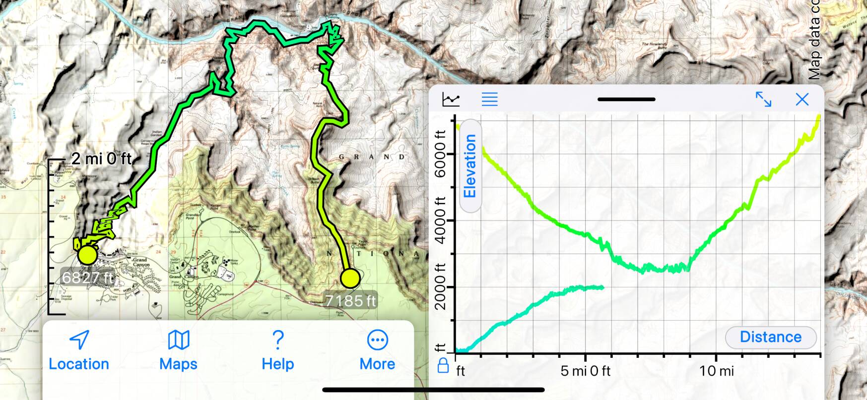
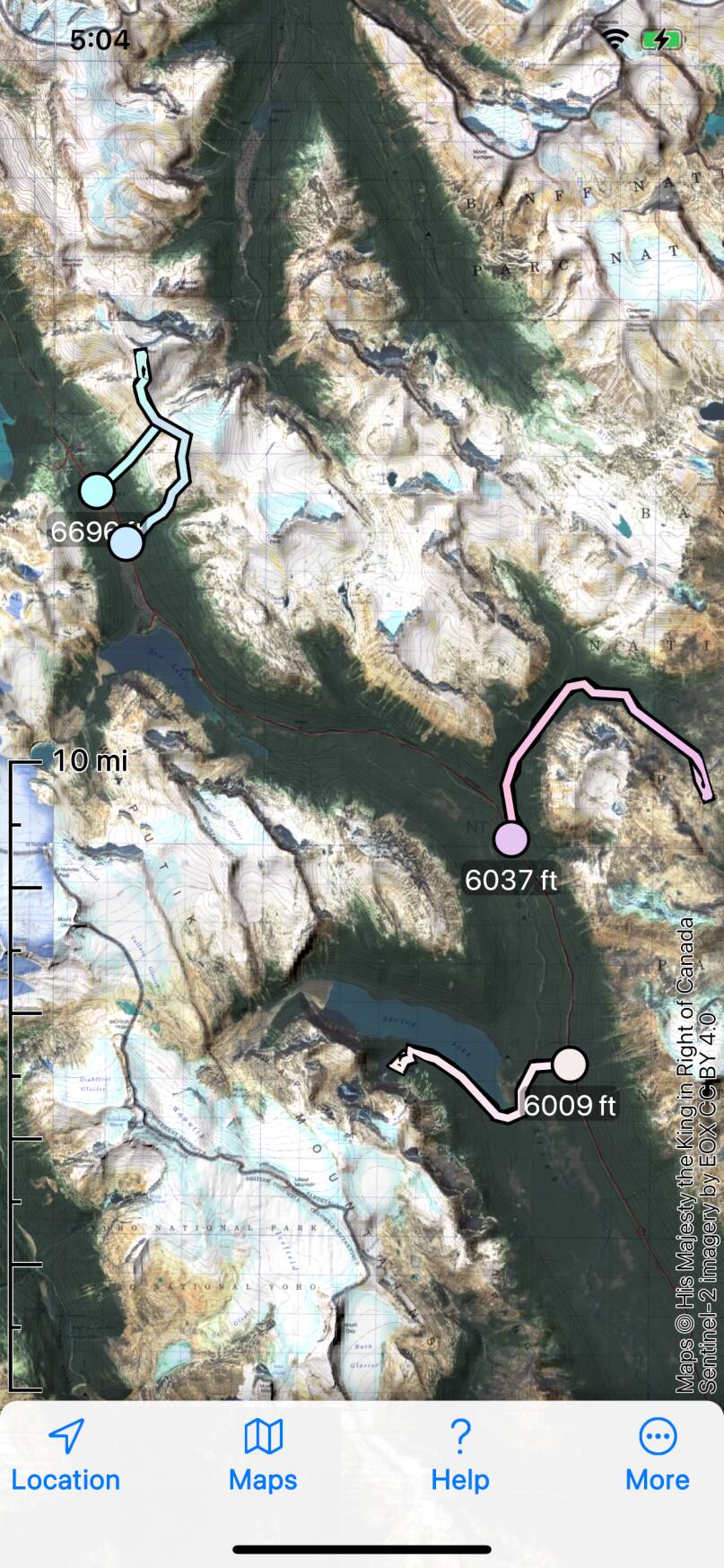
- Elevation determines color:
- The color is computed using a palette based on the elevation, so you can see how elevation varies along a route or track, for example. The color palette attempts to accommodate all elevations from Death Valley to Denali, so the actual color variation in relatively flat terrain will be modest; your feedback would be appreciated. This screenshot shows a Grand Canyon descent/ascent and a lower-altitude route:
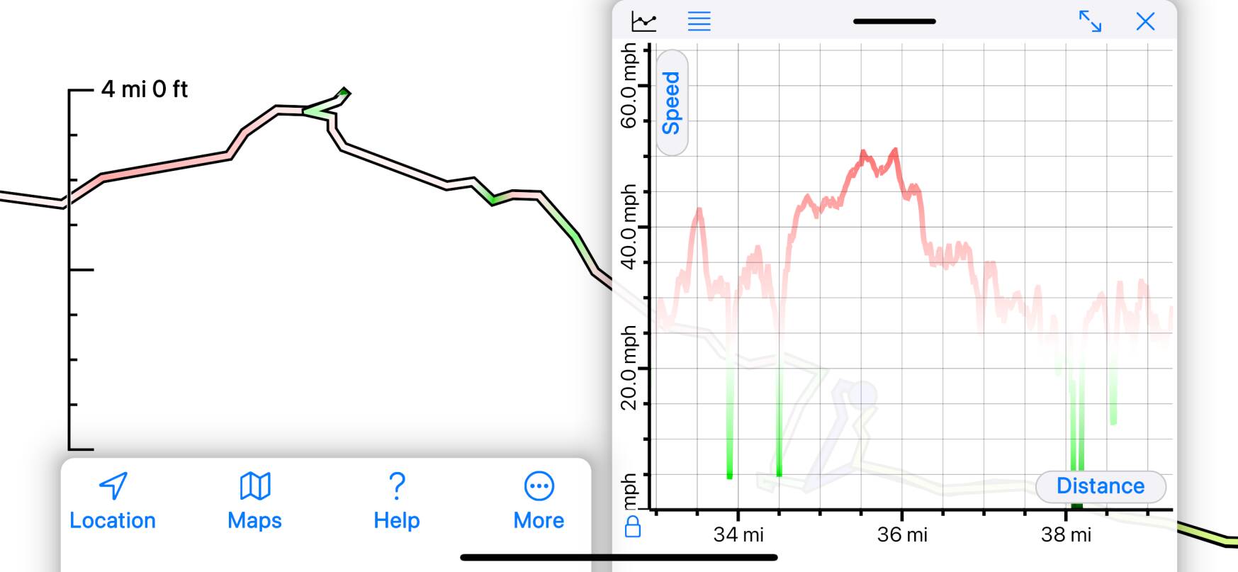
- Speed determines color:
- The color is determined by the speed along the track or route, with a palette representing speeds from zero to aircraft speeds (i.e. 0 - 500 mph). Your feedback about the usefulness of this palette for your track recordings would be appreciated. This screenshot shows a car journey:
- Time determines color:
- The color is determined in a random but deterministic way by the date and time. The idea is that you will be able to determine which items on the map are from the same trip because they will have similar colors, whereas items from for example a different trip to the same location will look rather different. Once again, please let us know if this works well for you.
- Filename determines color:
- The color is determined in a random but deterministic way by the name of the file containing the item, so all items in the same file will have the same color, but items from different files should have different colors.
- Names determine color:
- The name of the individual item, as well as the name of the file that contains it, are used to choose a color. This should result in all items having different colors.
Other Styles
No points shown and All points shown determine which of a track or route’s
points are shown. By default, only points that have been given a name, style, number etc.
(for example using the button while drawing a
route or recording a track) will be shown. No points shown causes even those points
to not be shown; All points shown causes all points to be shown.
All points shown is useful if you want to give a name or symbol to a
point on a track or route after creating it. Turn on “All points shown” for the track or
route, select the point you want to change and edit it, and then turn off “All points shown”.
Additional Symbols
If you’d like additional symbols in a future version of the app, please get in touch.
Most of the current symbols come from Apple’s SF Symbols
symbol collection. Apps are available to browse the available symbols - search the app
store for “SF Symbols”. If you would like something that’s not in that collection
that’s more work, but we’ll certainly consider it.
Import and Export
Styles are not a well-standardized feature of the GPX file format, so it’s
unlikely that styles that you choose in this app will be displayed if you export
the file to another app or website. Similarly, styles in imported GPX files
likely won’t be displayed correctly though the app does make some effort to
understand styles from a few other sources including our original Topo Maps app.
If you would like this support to improve, please get in touch and send us an
example file.
Technical Details of Styles
If you want to create GPX files using other software that Topo Maps 2 will display
with particular styles, you’ll need to understand more about the app’s style
system. We plan to write more about this later. Do get in touch if you are curious.

